Following are a couple of pictures with the key elements that I try to recreate (from top down: Library of Congress, San Diego Historical Society and the color photos are from one of my last trips to SoCal)

The Santa Fe depot as it looked in its early days.

This is a view from the 1930's looking down Broadway Avenue to the Pier
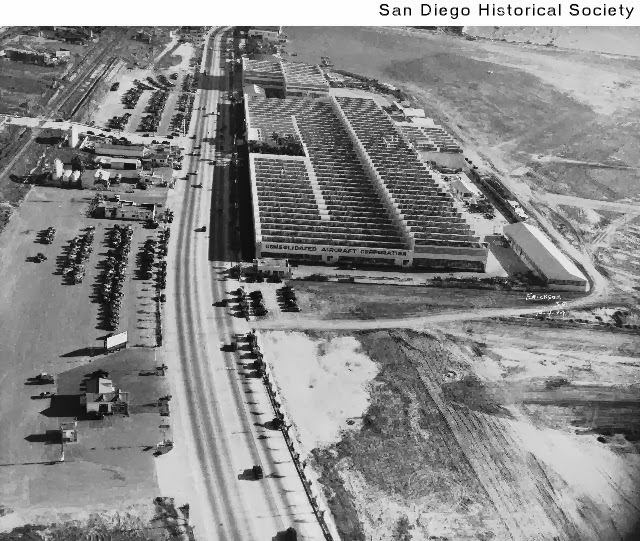
This view shows Consolidated Aircraft Company with part of Lindbergh Field to the right. The 4-lane road is Pacific Highway

The depot like it looks today, surrounded by Palm trees and skyscrapers

This is the turning wye with Washington Street leading into the US Marine Corps Recruiting Base (right). To the left are the fences of today's International Airport

This view shows the diverging tracks that pass under Pacific Highway

Here the highway crossed the tracks at the same level. I suppose that the wye was bridged for security reasons.

The lead tracks curve to the right into the Marine Base. In the background you see an Airport Tower and the tail of an airplane
No comments:
Post a Comment